

- お役立ち記事
- Satellite Positioning System Fundamentals and Latest Technology Trends for High-Precision Positioning Applications

その単価は妥当か。
AI が根拠付きで分析。
相見積の比較も発注も進捗管理も、ひとつの画面に。

Satellite Positioning System Fundamentals and Latest Technology Trends for High-Precision Positioning Applications

Satellite positioning systems are an essential part of everyday technology, enabling everything from navigation in cars to precise agricultural practices.
In recent years, advancements in these systems have opened new possibilities for high-precision applications, making them more reliable and accurate.
This article will explore the fundamentals of satellite positioning systems and discuss the latest trends in technology that are driving these enhancements.
目次
Understanding Satellite Positioning Systems
Satellite positioning systems, also known as Global Navigation Satellite Systems (GNSS), are networks of satellites that send signals to receivers on Earth.
These signals help determine the receiver’s location based on the time it takes for the signals to travel from the satellite to the receiver.
The most well-known systems include the United States’ Global Positioning System (GPS), Russia’s GLONASS, the European Union’s Galileo, and China’s BeiDou Navigation Satellite System.
How Satellite Positioning Works
The basic principle of satellite positioning involves trilateration, a method that uses multiple satellite signals to calculate precise positions.
A receiver calculates its position by measuring the time delay of signals from at least four satellites.
This delay is transformed into distance, helping triangulate the receiver’s position on Earth.
Sources of Errors in Positioning
While these systems are generally accurate, certain factors can introduce errors:
– **Signal Travel Delays**: Atmospheric conditions such as the ionosphere and troposphere can delay signals, affecting accuracy.
– **Multipath Effects**: Signal reflections off structures like buildings or mountains can cause errors.
– **Satellite Clock and Orbit Errors**: Imperfections in the satellite’s onboard clocks or its orbital data can introduce inaccuracies.
– **Receiver Noise**: The equipment used to receive signals can also contribute to errors.
Advancements in Satellite Positioning Technologies
Augmented Systems for Precision
To address and reduce errors, various augmentation technologies have been developed:
– **Differential GNSS (DGNSS)**: This system uses fixed reference stations with known positions to provide corrective data for GPS, improving accuracy.
– **Satellite-Based Augmentation Systems (SBAS)**: Such systems like WAAS, EGNOS, and MSAS utilize geostationary satellites that broadcast correction signals to enhance the regular GNSS.
– **Real-Time Kinematic (RTK)**: A method that uses a fixed ground station to provide precise corrections, achieving centimeter-level accuracy ideal for applications like surveying and precision farming.
Multi-Constellation and Multi-Frequency Usage
Using more than one satellite constellation simultaneously can significantly enhance accuracy and reliability.
This multi-constellation approach allows receivers to access more satellites, which helps in areas with poor GPS coverage.
Additionally, modern receivers that support multiple frequencies can reduce errors related to atmospheric delay, as different frequencies react differently to atmospheric conditions.
Innovations in Receiver Technology
Receiver technology has seen considerable advancements, aiding in high-precision positioning:
– **Miniaturization**: Smaller and more power-efficient receivers can be integrated into various devices, from smartphones to UAVs, enabling precise location tracking.
– **Enhanced Sensitivity**: Improved signal processing allows receivers to perform better in challenging environments, such as urban canyons or forests.
– **Machine Learning**: Incorporating AI and machine learning algorithms into positioning systems to predict and compensate for errors enhances system accuracy.
Applications Benefiting From High-Precision Satellite Positioning
Autonomous Vehicles
For autonomous vehicles, accurate and reliable positioning is crucial for navigation and safety.
RTK and similar technologies allow for exquisite precision, crucial in environments where even slight deviations can lead to significant navigation errors.
Agriculture
Precision agriculture relies on high-accuracy GPS technology to optimize planting, harvesting, and irrigation, leading to increased yields and reduced waste.
Farmers can use advanced positioning to monitor soil and crop health on a large scale efficiently.
Construction and Surveying
The construction industry benefits enormously from high-precision GPS as it aids in site planning and layout, ensuring that structures are built accurately to design specifications.
Surveyors use RTK and DGNSS technologies for detailed mapping and land assessment, crucial in various civil engineering projects.
Future Directions and Challenges
Integration with 5G Technologies
The integration of GNSS and 5G technology promises even higher precision in positioning.
5G networks can provide supplementary data that, when combined with GNSS, could enable real-time corrections and enhanced reliability.
Addressing Limitations
Despite advancements, challenges such as interference, spoofing, and jamming remain concerns for satellite positioning systems.
Developing advanced anti-jamming techniques and secure authentication processes will be crucial for maintaining system integrity and trustworthiness.
Expansion into New Territories
As technology continues to evolve, satellite positioning systems will expand into new domains like indoor and underground positioning, leveraging innovations like Wi-Fi and Bluetooth network data fusion to extend their capabilities beyond traditional open-sky applications.
In conclusion, the fundamentals of satellite positioning systems remain integral to our modern technological landscape.
Advancements in the field continue to push the boundaries of what is possible, enabling precise and reliable applications across various sectors.
As technology progresses, new innovations will emerge to enhance the accuracy and reliability of these systems further, paving the way for exciting future possibilities.
この記事の理解を深める
無料ホワイトペーパーをプレゼント
製造業の現場で使える実務資料(PDF)を無料でお届けします。"こんな資料が届きます" ↓ 下のボタンからどうぞ。
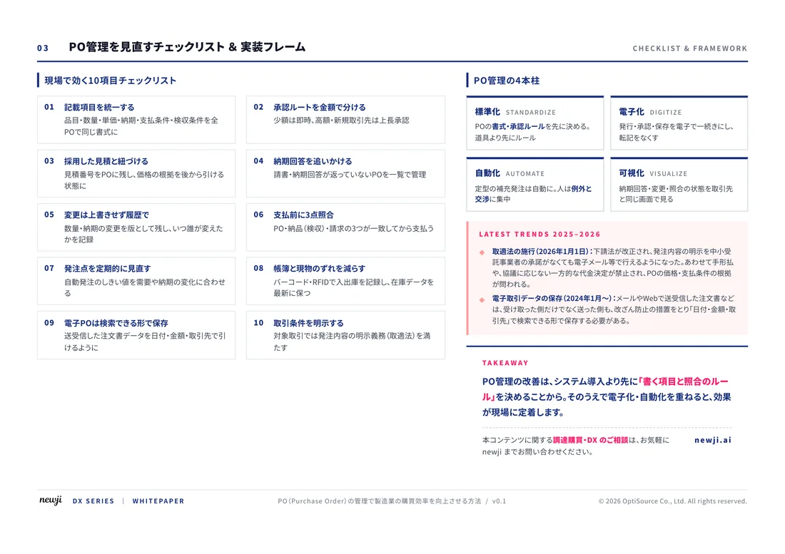
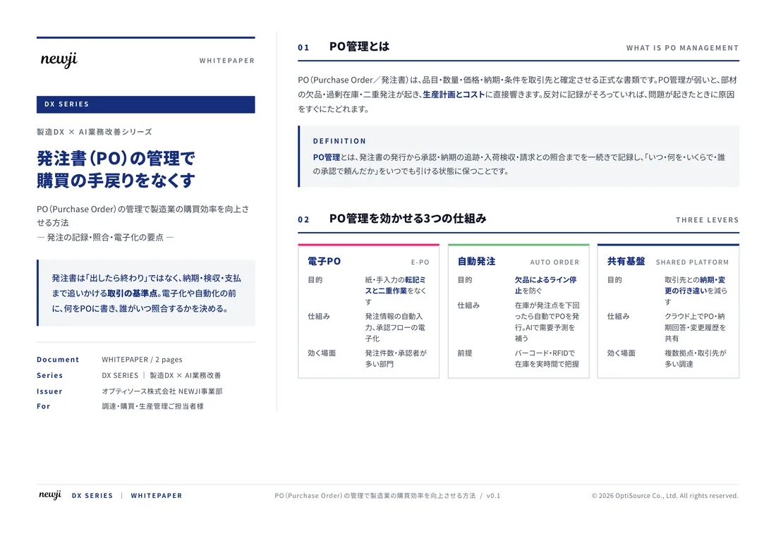
FREE DOCUMENT — サービス資料(PDF・無料)
製造業の見積・受発注クラウド
「Newji one」とは
Newji one は、製造業の調達・受発注に特化したクラウド/AIエージェント。見積依頼・発注書作成・進捗管理・承認をひとつの画面に集約し、AIが比較と異常検知を担当。最後の「GO」だけ人が押す仕組みです。
▶ 製造業の見積・受発注クラウド「Newji one」を、資料で見る(PDF・無料)
- 見積〜発注〜納期を一元管理。催促・転記のムダをゼロに
- AIが相見積もり比較と異常検知。あなたは判断だけに集中
- 取引先は「招待」で完全無料。自社コストだけで取引先ごとデジタル化
※ 取引先から招待された企業様は完全無料でご利用いただけます

 NEWJI総研
 OEM/ODM 生産委託
 AI/DX支援
 見積・発注クラウド Newji one
受発注が増えるほど、入力・確認・催促が重くなる。
受発注管理を“仕組み化“して、ミスと工数を削減しませんか。
見積・発注・納期まで一元管理できます。