

- お役立ち記事
- Basic configuration and principle of LiDAR

その単価は妥当か。
AI が根拠付きで分析。
相見積の比較も発注も進捗管理も、ひとつの画面に。

Basic configuration and principle of LiDAR

目次
Introduction to LiDAR
LiDAR, which stands for Light Detection and Ranging, is a remote sensing method that uses light in the form of a pulsed laser to measure variable distances to the Earth.
This technology is commonly used for applications in geography, forestry, agriculture, and even autonomous vehicles, among others.
Understanding the basic configuration and principle of LiDAR is essential to leveraging its full potential.
The Basic Configuration of LiDAR
LiDAR systems generally consist of four main components: the laser, the scanner and optics, the photodetector and receiver electronics, and the positioning and navigation systems.
Each component plays a crucial role in ensuring the accuracy and efficiency of the system.
The Laser
The heart of any LiDAR system is the laser.
It emits pulses of light which are crucial to the functioning of LiDAR since they are used to measure distances.
The type of laser can vary depending on the application, with some systems using infrared lasers and others using ultraviolet or visible lasers.
The wavelength of the laser affects its ability to penetrate different materials and can influence the accuracy of the measurements in various environments.
The Scanner and Optics
The scanner and optics are critical for directing the laser pulses across the target area or object.
Rotating mirrors are commonly used to achieve this scanning motion.
As the system scans, it collects a large number of data points which create a detailed three-dimensional map of the area.
The quality and precision of the optics used can significantly impact the resolution and accuracy of the data collected.
Photodetector and Receiver Electronics
Once the laser pulses hit an object, they bounce back to the LiDAR system, where they are captured by the photodetector.
The photodetector converts these light signals into electrical signals that are then processed by the receiver electronics.
The receiver measures the time it takes for each pulse to travel to the object and back, known as the “time of flight”.
This data is crucial for calculating the distances and creating a precise map.
Positioning and Navigation Systems
To accurately map the positions of the points collected, a LiDAR system must be equipped with a positioning and navigation system.
This typically involves a combination of GPS and Inertial Measurement Units (IMU).
The GPS provides location data while the IMU helps to monitor the orientation and movement of the LiDAR system, be it on an aircraft, drone, or vehicle.
Together, these systems ensure that the data collected is precisely georeferenced, allowing for the creation of accurate maps and models.
The Principle of LiDAR Operation
The principle behind LiDAR is relatively straightforward, relying on the measurement of the time it takes for a laser pulse to travel to an object and return.
This duration is used to calculate the distance between the LiDAR system and the object being scanned.
Given the speed of light is well known, the distance can be calculated with high precision by using the formula:
Distance = (Speed of Light x Time of Flight) / 2.
This calculation is repeated for each pulse emitted, which, thanks to the high frequency of the laser pulses, can range from tens of thousands to millions of pulses per second.
These continuous measurements create a dense point cloud that describes the surface of the scanned area.
Applications of LiDAR
LiDAR has myriad applications that make it an indispensable tool in various fields.
Geographic Mapping and Surveying
One of the most widespread uses of LiDAR is in geographic mapping and surveying.
It helps in creating highly accurate topographical maps and Digital Elevation Models (DEMs).
Civil engineers use it for planning and designing infrastructure projects, while environmentalists use it to detail forest canopies or monitor erosion patterns.
Agriculture
In agriculture, LiDAR assists in precision farming by providing detailed information on land elevation, which impacts water flow and soil properties.
Farmers use this data to optimize planting strategies and improve yields.
Forestry Management
LiDAR is extensively used in forestry management to measure tree height, canopy density, and biomass.
It assists in monitoring forest health and planning conservation efforts by providing data crucial for ecological assessments.
Autonomous Vehicles
In the realm of autonomous vehicles, LiDAR is fundamental in enabling the vehicles to “see” and navigate their surroundings.
The 3D maps created by LiDAR systems help autonomous vehicles detect obstacles and ensure they move safely and efficiently.
Challenges and Future of LiDAR
While LiDAR is a powerful tool, it does come with challenges that need addressing.
Data processing involves handling vast amounts of data, which can be both time-consuming and storage-intensive.
Additionally, the cost of high-quality LiDAR systems can be substantial.
However, advancements are being made to develop more affordable and efficient systems.
Looking forward, LiDAR continues to evolve with technological advancements.
Improvements in miniaturization and data processing are expanding the scope of LiDAR applications.
As these technologies advance, LiDAR will likely become more accessible and an even more integral part of various industries.
With its ability to provide precise, three-dimensional maps, LiDAR technology is an incredibly powerful tool.
By understanding its basic configuration and operating principles, one can make informed decisions about its applications and potential in various fields.
Whether in mapping, agriculture, forestry, or autonomous vehicles, the impact of LiDAR is undeniable and poised to grow further.
この記事の理解を深める
無料ホワイトペーパーをプレゼント
製造業の現場で使える実務資料(PDF)を無料でお届けします。"こんな資料が届きます" ↓ 下のボタンからどうぞ。
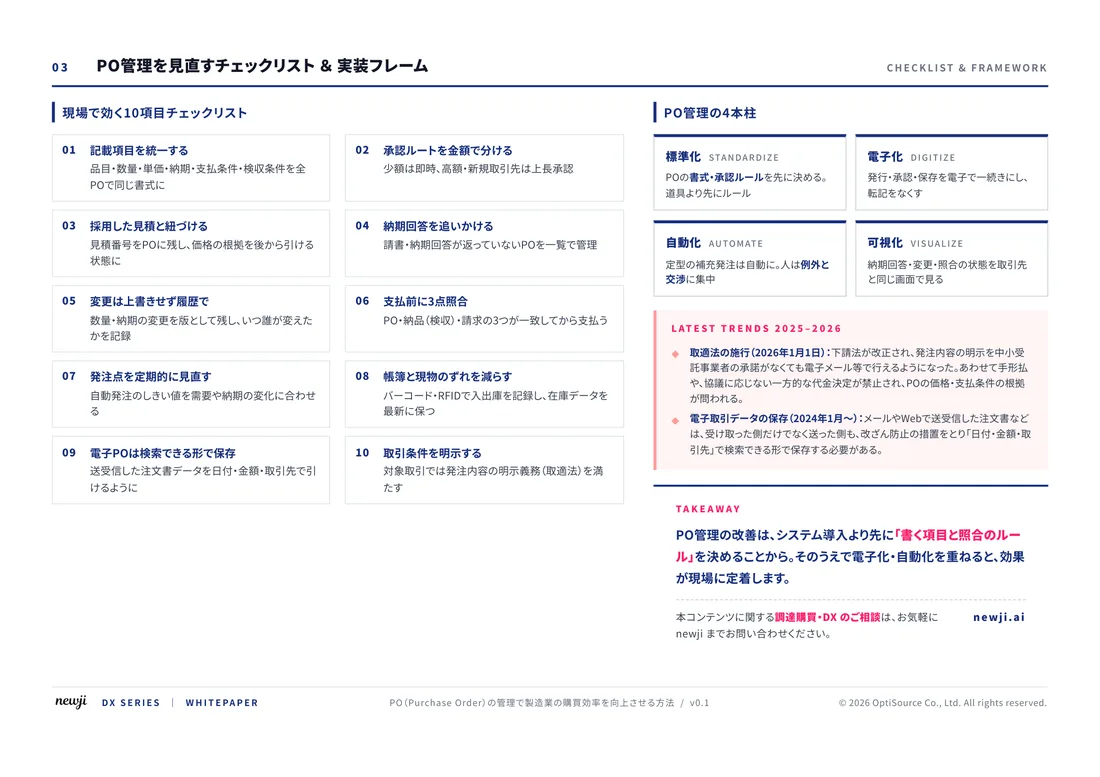
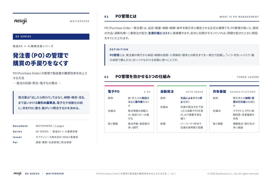
FREE DOCUMENT — サービス資料(PDF・無料)
製造業の見積・受発注クラウド
「Newji one」とは
Newji one は、製造業の調達・受発注に特化したクラウド/AIエージェント。見積依頼・発注書作成・進捗管理・承認をひとつの画面に集約し、AIが比較と異常検知を担当。最後の「GO」だけ人が押す仕組みです。
▶ 製造業の見積・受発注クラウド「Newji one」を、資料で見る(PDF・無料)
- 見積〜発注〜納期を一元管理。催促・転記のムダをゼロに
- AIが相見積もり比較と異常検知。あなたは判断だけに集中
- 取引先は「招待」で完全無料。自社コストだけで取引先ごとデジタル化
※ 取引先から招待された企業様は完全無料でご利用いただけます

 NEWJI総研
 OEM/ODM 生産委託
 AI/DX支援
 見積・発注クラウド Newji one
受発注が増えるほど、入力・確認・催促が重くなる。
受発注管理を“仕組み化“して、ミスと工数を削減しませんか。
見積・発注・納期まで一元管理できます。