

- お役立ち記事
- RTK positioning

その単価は妥当か。
AI が根拠付きで分析。
相見積の比較も発注も進捗管理も、ひとつの画面に。

RTK positioning

What is RTK Positioning?
RTK, or Real-Time Kinematic, positioning is a precise method used in surveying and navigation to determine exact locations on the Earth’s surface.
This technique relies on satellite positioning systems, like GPS, to enhance accuracy.
It uses two receivers: a base station and a rover.
The base station remains at a fixed location, while the rover moves to determine specific points.
How Does RTK Positioning Work?
RTK positioning operates by correcting satellite signals.
Usually, GPS signals can be affected by atmospheric conditions, making them less accurate.
However, RTK employs a base station that knows its exact position.
The base station receives GPS signals and calculates the errors.
It then transmits these corrections to the rover.
With these corrections, the rover can determine its location with high accuracy, often down to the centimeter level.
Why is RTK Positioning Important?
RTK positioning is vital for industries that require precise measurements.
For example, in agriculture, RTK helps farmers plant crops more efficiently by ensuring that equipment follows precise paths.
In construction, it aids in the accurate placement of structures and in surveying, ensuring detailed land maps.
The demand for precision in these fields makes RTK an essential tool.
Advantages of RTK Positioning
One major advantage of RTK is its high accuracy.
Traditional GPS can only provide a general location, but RTK gives exact details.
This level of precision is especially crucial for applications that cannot afford errors.
Moreover, RTK provides real-time data, ensuring immediate results, which saves time and boosts productivity.
RTK vs. Traditional GPS
While both RTK and traditional GPS use satellites to determine locations, they differ significantly in accuracy.
Traditional GPS offers accuracy within a range of meters.
In contrast, RTK positioning can pinpoint locations with centimeter-level precision.
This difference can greatly affect outcomes in fields like surveying or mapping.
RTK requires a base station to adjust signals, while traditional GPS does not.
This dependency might increase costs, but for many, the improved precision is worth it.
Applications of RTK Positioning
In agriculture, RTK positioning helps automate tractors for efficient farming, ensuring straight lines and even planting.
In construction, it allows for precise leveling and placement of structures, reducing errors and waste.
Surveyors use RTK to create detailed maps and to ensure that boundaries and landmarks are accurately placed.
In addition, RTK is essential for drone operations where detailed mapping and real-time data are crucial.
Challenges of Using RTK Positioning
Despite its advantages, RTK positioning has challenges.
The need for a base station can limit its use in remote areas.
Additionally, good communication between the base and the rover is essential, meaning any obstruction can affect accuracy.
Satellite signals can also be affected by atmospheric conditions, though RTK’s corrections usually mitigate this issue.
Future of RTK Positioning
RTK technology is continually evolving.
As the demand for precision increases, so does interest in improving RTK systems.
Future advancements may include enhanced communication systems to extend the range of base stations.
There might also be developments in satellite technology, offering even more accurate signals.
As industries strive for precision, RTK positioning is set to play an increasingly significant role.
Conclusion
RTK positioning is a groundbreaking advancement in the realm of navigation and surveying.
Its ability to provide precise, real-time data makes it indispensable to many industries.
Despite certain challenges, its benefits far outweigh its drawbacks.
As technology progresses, RTK will only become more effective and accessible, cementing its place in future applications.
この記事の理解を深める
無料ホワイトペーパーをプレゼント
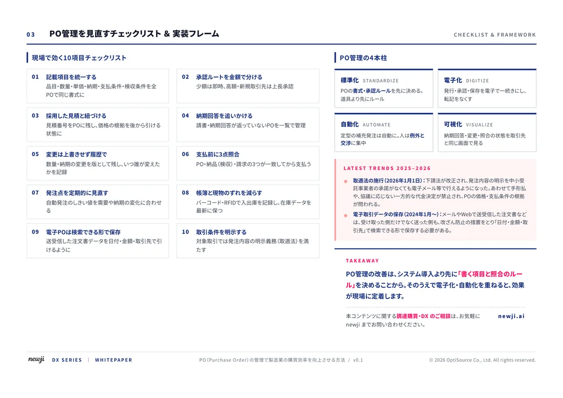
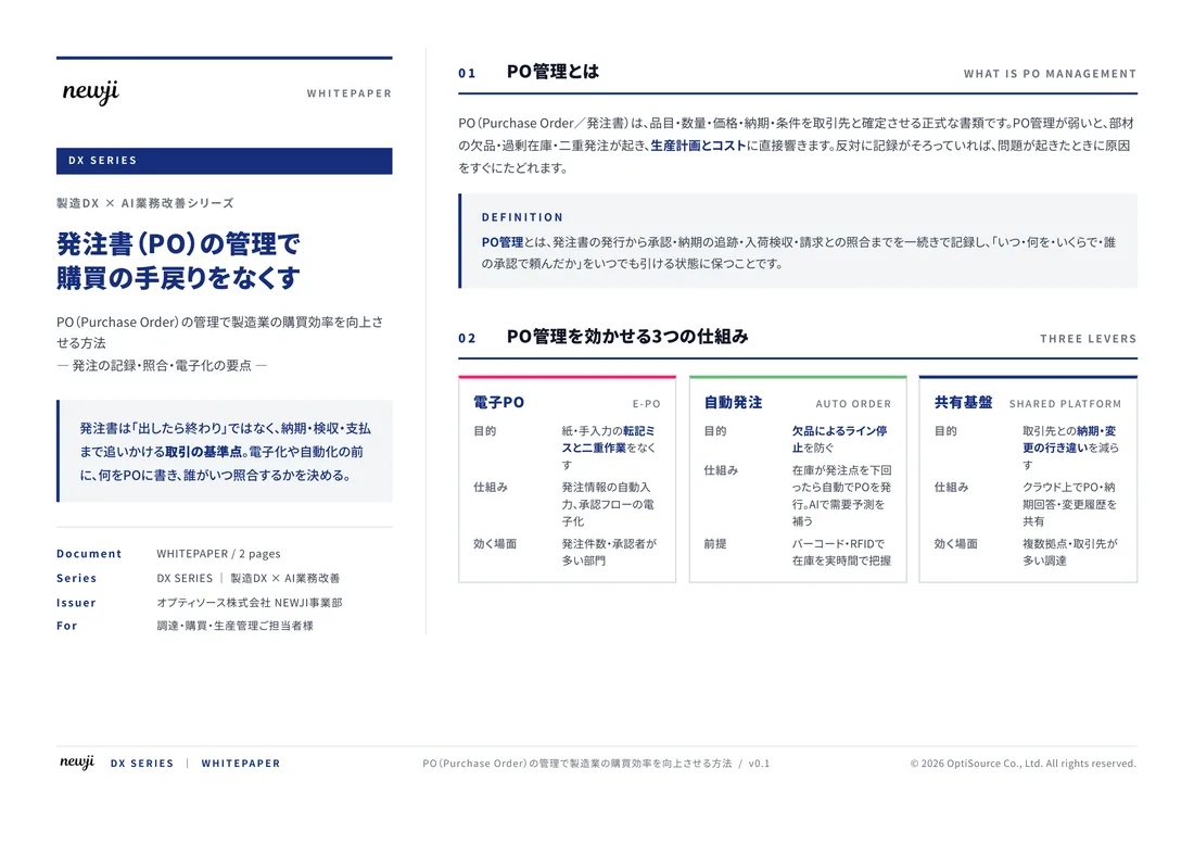
製造業の現場で使える実務資料(PDF)を無料でお届けします。"こんな資料が届きます" ↓ 下のボタンからどうぞ。
FREE DOCUMENT — サービス資料(PDF・無料)
製造業の見積・受発注クラウド
「Newji one」とは
Newji one は、製造業の調達・受発注に特化したクラウド/AIエージェント。見積依頼・発注書作成・進捗管理・承認をひとつの画面に集約し、AIが比較と異常検知を担当。最後の「GO」だけ人が押す仕組みです。
▶ 製造業の見積・受発注クラウド「Newji one」を、資料で見る(PDF・無料)
- 見積〜発注〜納期を一元管理。催促・転記のムダをゼロに
- AIが相見積もり比較と異常検知。あなたは判断だけに集中
- 取引先は「招待」で完全無料。自社コストだけで取引先ごとデジタル化
※ 取引先から招待された企業様は完全無料でご利用いただけます

 NEWJI総研
 OEM/ODM 生産委託
 AI/DX支援
 見積・発注クラウド Newji one
受発注が増えるほど、入力・確認・催促が重くなる。
受発注管理を“仕組み化“して、ミスと工数を削減しませんか。
見積・発注・納期まで一元管理できます。