

- お役立ち記事
- The forefront of complementary technology that improves the accuracy of aerial laser surveying

その単価は妥当か。
AI が根拠付きで分析。
相見積の比較も発注も進捗管理も、ひとつの画面に。

The forefront of complementary technology that improves the accuracy of aerial laser surveying

目次
Introduction to Aerial Laser Surveying
Aerial laser surveying, also known as Light Detection and Ranging (LiDAR), is a sophisticated method used to make high-resolution maps.
This technology employs light in the form of a pulsed laser to measure variable distances to the Earth.
These light pulses, combined with data recorded by the airborne system, generate precise, three-dimensional information about the shape and surface characteristics of the Earth.
Why Accuracy Matters in Aerial Laser Surveying
Accurate data is critical in fields such as urban planning, forestry, and environmental science, where precise maps are essential.
Errors in surveying can lead to significant miscalculations in planning and execution.
Thus, enhancing the accuracy of LiDAR technology is of utmost importance to improve outcomes in various professional sectors.
Challenges in Aerial Laser Surveying
Despite the advanced technology involved in LiDAR, it is not without its challenges.
Environmental conditions such as fog, rain, or heavy vegetation can significantly affect the accuracy of data collection.
Additionally, the position of the sun and shadows cast by structures or natural formations can also introduce errors into the data.
Understanding and overcoming these challenges is necessary for the continued advancement of this technology.
Complementary Technologies Enhancing LiDAR
To improve the accuracy and reliability of aerial laser surveying, complementary technologies are being integrated into the processes.
These technologies work to support and enhance the capabilities of traditional LiDAR systems, mitigating the challenges posed by environmental factors.
Global Positioning Systems (GPS) and Inertial Measurement Units (IMUs)
GPS and IMUs have become instrumental in improving the accuracy of LiDAR.
A high-precision GPS can provide exact location data, which is crucial for aligning LiDAR data with the correct geographical points.
IMUs, on the other hand, measure the rate of acceleration and alterations in angular speed, crucial for maintaining data integrity in environments where GPS signals are unreliable.
Integration with Machine Learning Algorithms
The integration of machine learning algorithms with LiDAR data can significantly boost data accuracy.
Machine learning can help in the processing and interpretation of large sets of LiDAR data, enabling the system to learn from patterns and improve its predictions.
This automation essentially reduces the potential for human error and accelerates the data processing time.
Advancements in Sensor Technology
The development of more advanced sensors is another area that holds promise for enhancing LiDAR accuracy.
Sensors capable of capturing data at higher resolutions can improve the quality of the resulting maps.
Additionally, sensors are being developed to cover different spectrum ranges, enabling better performance in challenging environmental conditions.
Fusion with Satellite Data
The fusion of aerial LiDAR data with satellite imagery presents another technological advancement.
Satellite data can provide larger-scale context and help fill in gaps where LiDAR data may be sparse due to obstructions.
This fusion can lead to more comprehensive mapping and enhanced data accuracy, especially in areas that are difficult to access or heavily obstructed.
The Role of Cloud Computing
Cloud computing has revolutionized many industries, and aerial laser surveying is no exception.
By utilizing cloud-based platforms, large amounts of LiDAR data can be stored, shared, and processed with remarkable efficiency.
This facilitates collaboration and access to up-to-date software tools that can further refine data accuracy.
Future Prospects and Innovations
Looking forward, the future of aerial laser surveying promises even greater accuracy and efficiency.
Continuous advancements in sensor technology, machine learning, and data fusion methods are paving the way for more reliable and cost-effective surveying methods.
Innovations such as real-time data processing and the development of autonomous surveying drones signal a transformative period ahead for the industry.
Conclusion
The accuracy of aerial laser surveying is paramount for its application in various critical fields.
The integration of complementary technologies is enhancing the accuracy and reliability of this powerful tool.
With ongoing research and technological advancements, aerial laser surveying is poised to become even more accurate and indispensable in shaping the future of industries reliant on precise mapping and data collection.
この記事の理解を深める
無料ホワイトペーパーをプレゼント
製造業の現場で使える実務資料(PDF)を無料でお届けします。"こんな資料が届きます" ↓ 下のボタンからどうぞ。
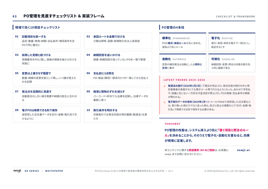
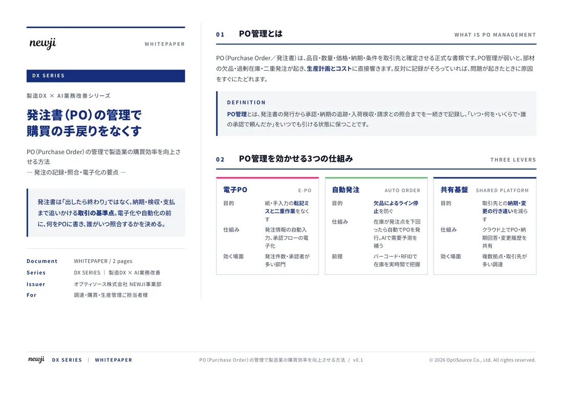
FREE DOCUMENT — サービス資料(PDF・無料)
製造業の見積・受発注クラウド
「Newji one」とは
Newji one は、製造業の調達・受発注に特化したクラウド/AIエージェント。見積依頼・発注書作成・進捗管理・承認をひとつの画面に集約し、AIが比較と異常検知を担当。最後の「GO」だけ人が押す仕組みです。
▶ 製造業の見積・受発注クラウド「Newji one」を、資料で見る(PDF・無料)
- 見積〜発注〜納期を一元管理。催促・転記のムダをゼロに
- AIが相見積もり比較と異常検知。あなたは判断だけに集中
- 取引先は「招待」で完全無料。自社コストだけで取引先ごとデジタル化
※ 取引先から招待された企業様は完全無料でご利用いただけます

 NEWJI総研
 OEM/ODM 生産委託
 AI/DX支援
 見積・発注クラウド Newji one
受発注が増えるほど、入力・確認・催促が重くなる。
受発注管理を“仕組み化“して、ミスと工数を削減しませんか。
見積・発注・納期まで一元管理できます。